Squak Mountain: a Potential New Favorite

On July 11, I considered skipping my intended hike. Hey, it happens to all of us. But when I saw high, wispy clouds, I convinced myself that it could be a good day to get a view of Mt. Rainier from Debbie’s View on Squak Mountain. Ajax picks up on clues quickly; he whined excitedly the night before when he saw my backpack. Committing to 52 unique adventures with him kept me engaged and interested for the past seven months. But what sent me to the car that morning was the idea of a view and of hearing varied birdsong. By visiting Squak’s Central Peak, we may have identified a new favorite mountain to explore.

Like Tiger and Cougar, Squak Mountain provides a lovely interwoven lattice of trails that result in a "choose your own adventure" ramble, just what I was looking for.
Like Tiger and Cougar, Squak Mountain provides a lovely interwoven lattice of trails that result in a “choose your own adventure” ramble, just what I was looking for.

Wrong Turn

As I drove past the Poo Poo Point trailhead off Exit 17, I realized that Cougar and Squak Mountain were accessible from Exit 15. Oops! I’d been on autopilot, listening to an audiobook about becoming more productive. Ironic, I know. Assuming May Valley Road would eventually lead me to something we could hike, I continued south and then turned west.

We pulled into the May Valley parking area to find 5-6 cars already dotting the lot. A solo trail runner stretched at her car. Cedar waxwings squeed near the Portapotties. I have never hiked on Squak before, so I figured we’d take our chances. If not than Debbie’s View and Margaret’s Way (the westmost trailhead, 6.5 miles with 1500′ gain), we’d find something else for our 48th ramble.

Squak Mountain: a Potential New Favorite
This time of year the bridges all cross dry stream beds. An invitation to visit seasonally to see the changes!

Benefits of May Valley Trail

From the May Valley Trailhead, we followed signs for Central Peak (6.6 miles with 2,320’ gain). My auto-pilot mistake resulted in finding an even more appealing option than West Tiger 3 (5 mi. 2100′ gain).

On our ascent, we encountered only three people: a woman and her dog (who admitted she never sees anyone on that trail, and we’d have the upper mountain to ourselves) and two solo trail runners. The May Valley Trail on the south side of Squak gets very little highway noise. The mountain has not been logged like Tiger, and we found plenty of opportunities to create our own adventure. The only drawback this time of year is the lack of running water. Fortunately, I carry plenty for Ajax although he prefers streams.
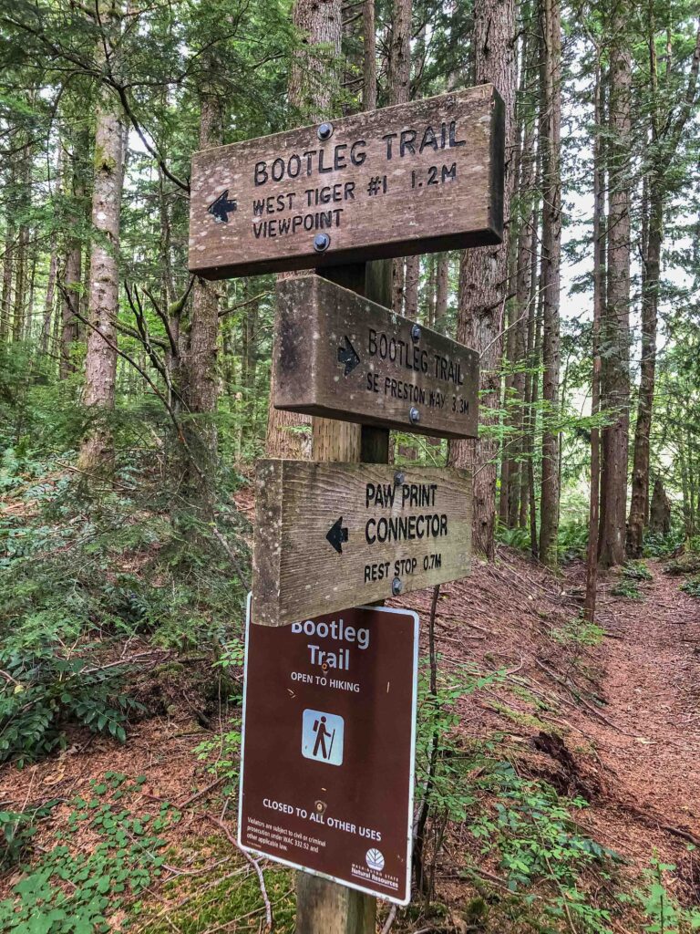
Encountering this sign on Squak Mountain piqued my curiosity about the Bullitt Family legacy.

Solitude and Quiet

The May Valley trail is lovely, lush, green, and well-signed. I did some research afterward to find out more about the Bullitt Family who once owned much of the land and donated it to the state as a wilderness public park. I don’t often learn about the history of a place ahead of time (especially if I “wing it”!) but in this case, I was curious and wanted to know more.

On our solitary journey, we heard 22 bird species, including a great horned owl, downy, hairy, and pileated woodpeckers, a Steller’s jay (who, interesting fact, are particularly fond of eating baby hummingbirds!), Swainson’s thrushes (who sing my favorite birdsong), Cedar waxwings (the masked “raccoons” of the bird world), brown creepers, and black-headed grosbeaks.

(By comparison, during a recent hot-weather visit to Snow Lake, we encountered so many people that I only heard eight species.) I also shot 53 photos including trail signs, acting as breadcrumbs that could help us navigate back to our car.  

Tiger, Cougar, and Squak all have excellent trail signs to help you navigate.

Squak Mountain: Bullitt Fireplace

One of the reasons I love exploring is feeling like an adventurer and discovering curious new-to-me things. When I saw the sign for Bullitt Fireplace, I had no idea I’d actually find the remains of a stone fireplace, the remnant of a two-room vacation cabin built in 1952 by Stimson Bullitt. That sparked my imagination. How long did it take to build it? Where did they get the materials? Did they have to bushwhack or did they have crude roads to haul rocks and timber? How often did they use it? And why did vandals destroy it?

I did some digging later to learn more about Charles Stimson “Stim” Bullitt. He had the cabin built in 1952 as a weekend retreat and climbed in the Cascades until the age of 87. At 62, on his third try at North America’s highest peak, Bullitt summited 20,320-foot Denali. His family owned and managed Seattle’s KING radio and TV stations, and his extensive real estate holdings included 590 acres on Squak Mountain which the Bullitt family later donated to the state to form the nucleus of Squak Mountain State Park. Hiking gives me a growing appreciation for what this land looked like before settlers “conquered” and tamed it.

A picnic table set at Bullitt Fireplace, all that remains of the Bullitt Family cabin.

Squak Mountain: Chybinski Loop

We continued beyond Central Peak, expecting to find a view somewhere, but we missed the power station and reached a sign for Phil’s Trail and Old Griz before backtracking. Determined to see what else we could find, we decided to visit West Peak. Perhaps it would have more of a view.

Chybinski Loop includes a very steep trail to a tiny sign for West Peak, where some sort of shack must have once stood but has since been flattened. I had the brilliant idea to find the hook-up of the loop instead of backtracking. “I’m not going back up that,” I thought. Famous last words.

All that remains of the shack at West Peak.

Squak Mountain: Debbie’s View

Eureka! Only .3 miles farther, we found signs for Debbie’s View, our original destination. As we added yet another extension, I did the mental math. Could we end up covering ten miles round trip? Unfortunately, the low clouds obscured any view we might have had of Mt. Rainier, so we didn’t linger. Then I got the bright idea to drop down to Margaret’s Way and return to May Valley along the perimeter trail.

Halfway down the wide, hardened trail toward Margaret’s Way, we encountered three women with a dog, followed by three others a few minutes behind them. Out of curiosity, I asked if they knew how much farther the perimeter trail was. One of the hikers – the one who spoke English – said I was mistaken, and I would need to backtrack to Bullitt Gorge. Bummer.

Goatsbeard, bleeding hearts, and clouds - but no view of Mt. Rainier from Debbie's View.
Goatsbeard, bleeding hearts, and clouds – but no view of Mt. Rainier from Debbie’s View.

Hasty Retreat

Always question assumptions! Fortunately, on an overcast day, more mileage never hurts. We still had water and food, and the shade and clouds were keeping it cool enough for Ajax. We backtracked at high speed, quickly leaving them behind to regain our solitude. By that point, I no longer felt as confident in my assumption that Bullitt Gorge would return us to May Valley (it does.)

Faced with adding even more mileage if I turned out to be wrong, I chose the known path back. My commitment to “not go back up that,” referring to Chybinski Loop? It honestly wasn’t as bad the second time around.

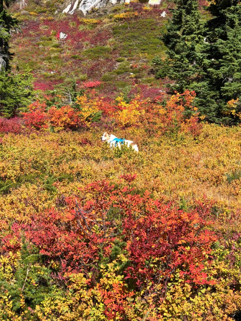
Spot the pup! The storm devastation through thick rambling woods on Squak Mountain's Chybinski Loop.
Spot the pup! The storm devastation through thick rambling woods on Squak Mountain’s Chybinski Loop.

Lesson Learned

The takeaway message from this outing was clear. If at first, you don’t succeed, try, try again. It was apparent when we elected to start from a different trailhead that we needed to be flexible and open to discovery. By staying open to possibility, I reminded myself that mistakes are opportunities, something that people with a growth mindset embrace. Maybe I could be developing a growth mindset after all.

Fortunately, we were able to link trails to reach our intended destination (Debbie’s View) with solitude, exploration, and birdsong along the way. It might not have been what we originally set out to do, but I’m happy I took the wrong turn.

Radio towers at the top of Squak's Central Peak.
Radio towers at the top of Squak’s Central Peak.

Change Meets Year Three

Such a coddiwomple is a fitting metaphor to kick off the third year of this blog. When I started blogging on July 31, 2021, during the middle of a pandemic, I wasn’t sure where I was headed or if this “blog thing” would even work out.

Year One Recap

In starting my blog, I knew only that I wanted something meaningful, memorable, and good to come out of the dregs of COVID. Those first six months were a time of trial and error until I developed my voice, message, and style.

The second six months between February and August 2022 were my “heal from a broken right wrist” months. Change became more difficult but mandatory as I battled to rehab my right arm while maintaining a household and handling a busy season of online clients. But I kept going despite facing three major health challenges.

My daughter and I are visiting as many alpine lakes as we can this summer. Mirror Lake via the PCT was ramble 49 on July 13, 2023.

Year Two Recap

From August 2022 to January 2023, I confronted an empty nest for the first time. Our daughter attends a local university and likes coming home most weekends. So empty nest became a “partly empty nest” as we adjusted to five days without her, and two days with her.

To help me cope, I developed the Active Ajax Adventures challenge (52 nonrepeated greenspace rambles) which we successfully completed in July 2023. Now that she’s home for the summer, I find myself naturally, rapidly, and comfortably evolving and growing. But what will happen when she returns to college?

The author enjoys a dip in Snow Lake at Exit 52 on July 19, 2023, during Ramble 51.

Year Three Projections

My grandiose plans for year three included diving deep into the “ABCs of Change.” But in sharing my ideas with my husband and writing partners, it became evident that I would be restricting myself — to the point of getting stuck before I ever started. Have you ever made so many rules or placed so many limits on yourself that you come to a complete standstill? Yup.

So instead, this year I will examine the mental aspects of change. To quote one of my wise writing partners, “To write about whatever moves or inspires me.” That might mean becoming more vulnerable, which terrifies me. I see far more growth potential there than in writing what I’ve come to see as my “safe” trip reports.

Look for the beauty in everything, including mistakes. Mistakes are our greatest teachers and point out unique learning opportunities.

Join me in year three on a continued journey through change, to move forward and get unstuck.

Blog One Hundred: Tiger’s Poo Poo Point on the Fourth

For this week’s Active Ajax Adventure, my intentions were to find a longer, shaded hike that would provide uninterrupted solitude, avoid road construction, and beat the holiday crowds and summer heat. This was ramble 46 (and hike 12) on the year but more importantly, potential material for blog one hundred. We visited West Tiger 3 from Poo Poo Point, making a giant loop covering ten miles and about 3000′ elevation gain.

Cross to the "obvious trailhead", in this case, marked with a parachute and flag.
Cross to the “obvious trailhead”, in this case, marked with a miniature parasail and flag.

The Solitude of an Early Start

I’d heard that people love to watch parasailers take off from Poo Poo Point, so we needed an early start. I’d never been on this trail before so I wasn’t quite sure what to expect. How early was “early”? Would the trailhead be as obvious as the description made it out to be? Would it be as crowded as “the highway” from Exit 20?

Ajax and I pulled into the parking lot at 6:15, delighted to find only eight other cars. Score! As we started up the well-maintained rock trail I felt like I was climbing Mother Nature’s Stairmaster. We spotted a trail runner on the way down, a woman walking her dog, and a pair of trail runners who passed us going up, but for the most part, we had the trail to ourselves.

The first part of Poo Poo Trail is rock, rock, and more rock through beautiful dense woods. Once you complete the switchbacks the traffic noise fades away.

The day served up such feathered lovelies as olive-sided flycatchers (drink! three! beers!), Swainson’s thrushes (an ascending melodic spiraling song), western tanagers, a pileated woodpecker (one of my favorite birds), and chestnut-backed chickadees. As we warmed up, the stiffness in my lower back loosened up and some unusual hip discomfort on the left side disappeared. We were both in our element.

Poo Poo Point

We reached a magnificent view of Mt. Rainier in less than an hour. We paused for some photos and I asked another hiker if he knew which path would take us to West Tiger 3. I’d seen a gravel service road on the map that looked promising, but he insisted I continue to Poo Poo Point.

Rainier on July 3 from just below Poo Poo Point about 1/4 mile.

“Once you reach it, take the trail behind the restroom.” I thanked him for the information.

“It’s very far,” he added, looking at me as though wondering whether I’d started from the wrong trailhead.

“I know,” I assured him. “That’s what I’m looking for.”

Less than ten minutes later, we reached the vacant Poo Poo Point with a view of Lake Sammamish and all points west. Squak. Cougar Mountain. Seattle. The Olympics.

Ajax investigates the launching area where we'd later see parasailers take off. But when we arrived around 7:15 there was only one person with a pair of binoculars.
Ajax investigates the launching area where we’d later see parasailers take off. But when we arrived around 7:15 there was only one person with a pair of binoculars.

Beyond Poo Poo Point to One-View

Once we’d taken photos from Poo Poo Point, we continued toward the restroom and found a trail leading into the dense woods beyond it. I am well-acquainted with West Tiger 3, but exclusively from the north. How hard would it be to find One-View Trail?

It turns out that the signage everywhere on Tiger is excellent. We soon found ourselves on One-View, and I was looking forward to the view. Except it must be named for the only view it has: green, green, and more green. Enormous tree stumps. And several precious orange tiger lilies.

At the junction of One-View and Tiger Mountain Trail, we headed toward Tiger 2 and the logging zone. Now I knew exactly where we were, even though I’d never been on this part of the trail before.

Even the stumps have eyes. A selfie on One-View Trail.

Tiger Mountain Trail: TMT

The more I explore Tiger Mountain, the more interest I have in doing the entire 15-mile long TMT. Apparently, portions of the trail will be intermittently closed through the fall of 2024, but we didn’t encounter any closures. We did, however, discover parts of the trail that are overgrown, eroded, or muddy, so perhaps there are plans to fix those problems.

An eroded portion of the trail where a giant tree root system has collapsed.

Plenty of short bridges traverse steep ravines and the worst of the mud. I sensed that both the TMT and Railroad Grade, at least between Poo Poo and West Tiger 3, don’t experience heavy foot traffic. We had the trail to ourselves, highly unusual for a beautiful summer holiday weekend. Win!

Once we reached a thinner part of the forest, I knew we must be approaching the logged portion of the mountain. In just two years, West Tiger 3’s barren, slashed, and ugly summit has become transformed into a lush alpine meadow with beautiful lupines, daisies, and foxgloves. And the views! Oh my. We shared the summit with one man when we arrived around 9 a.m.

Ajax takes time to smell the foxgloves.
Foxgloves, an erratic boulder, and chopped tree stumps.

Section to Railroad Grade

Once we left the summit of West Tiger 3, I searched for a stick to help me down the steep “unmaintained” trail known as Section Line. It is even steeper than Cable Line, and in the dry conditions we’ve had, it’s like walking on marbles. I’ve slipped enough in the past five years to last a lifetime; I wasn’t taking any chances.

Fortunately, with all the recent logging, there are plenty of sticks to choose from. Mother Nature provided a nice walking stick and I left it at the sign marking Section Line and Railroad Grade. May someone else benefit from it as well.

We ventured onto another new-to-us trail looking for the junction with One-View and our return to Poo Poo Point.

I believe this plant is called Goats' beard but don't quote me on that.
I believe this plant is called Goats’ Beard, but don’t quote me on that.

Return To Poo Poo Point

We returned to Poo Poo Point around 10:15 where plenty of spectators had gathered to watch parasailers take flight. Had the car in the parking lot hauled up all of the chutes? Or do the parasailers carry them up themselves?

Watching parasailers take off from Poo Poo Point.

As I watched more and more people hiking up from the Poo Poo Point trailhead, I realized how dramatic the contrast was between the solitude we’d experienced during the first four hours of our hike and the holiday crowd watching at the Point. I realized that on a sunny Monday morning, the day before Independence Day, Poo Poo is probably just as crowded as Rattlesnake Ledge. Fortunately, we had less than an hour to return to the car.

We took one more pause at the overlook for a shot of my favorite pup and my favorite mountain.

We’ve reached the end of blog one hundred. I am thrilled you’re continuing on this journey with me. I will be taking most of July to figure out the direction to take for year three. I’ll return in August with exciting new material.

Expect the Unexpected in Whittaker Wilderness

Making your way through obstacles, struggles, and change is tough work. Especially when your obstacles blindside you. Ajax, my daughter, and I explored the Whittaker Wilderness and environs on Cougar Mountain. And the best tip I can supply from that trip is to expect the unexpected.

Shy Bear Pass and Doughty Falls will always remind me of hiking over the boardwalk with two of my favorite companions, my daughter and my dog Ajax. We all faced unexpected obstacles on this hike.

Previous Blog Posts

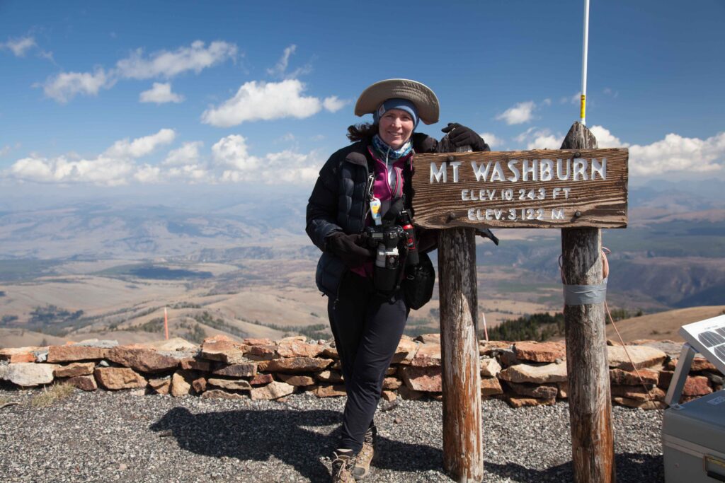
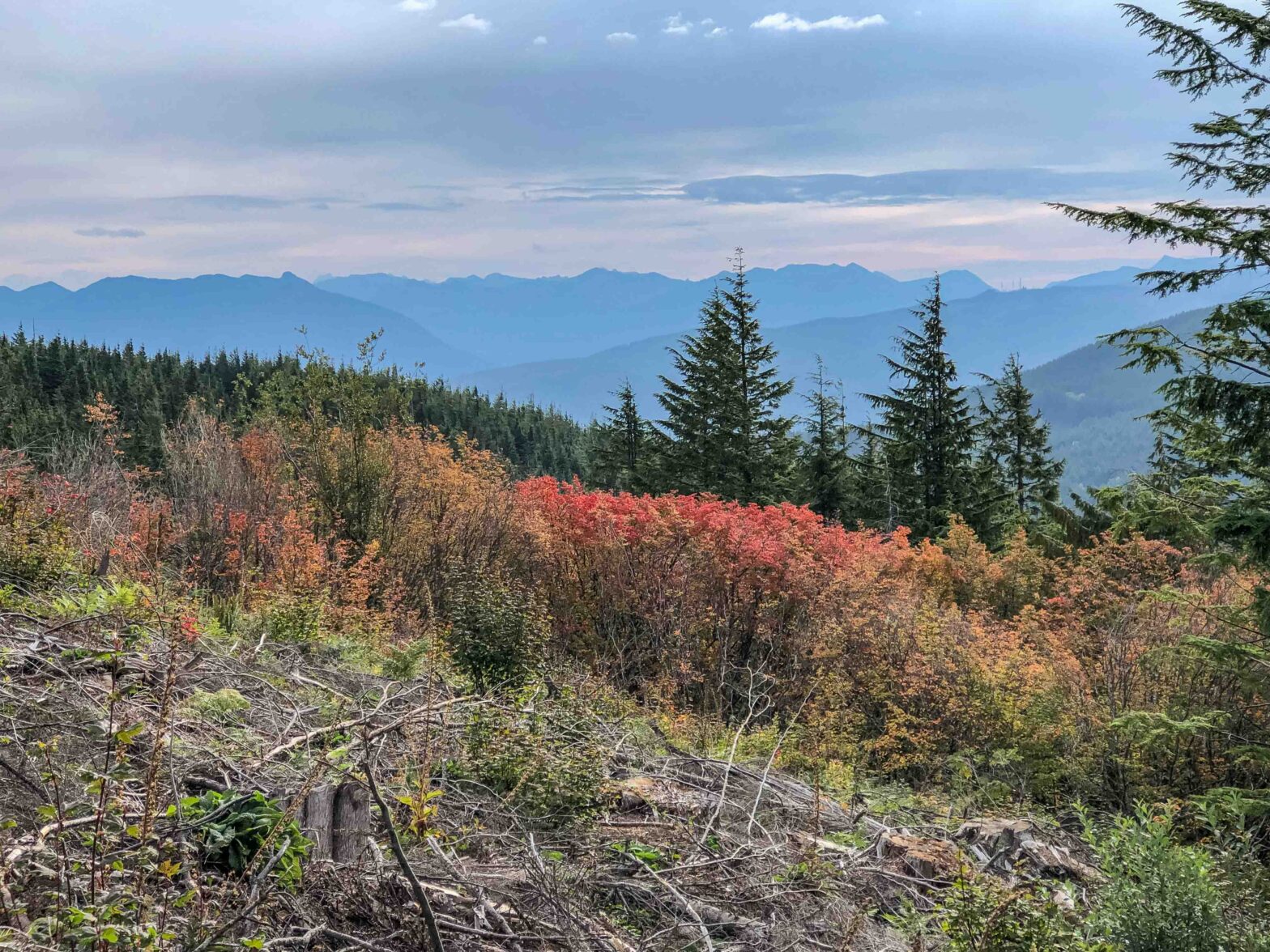
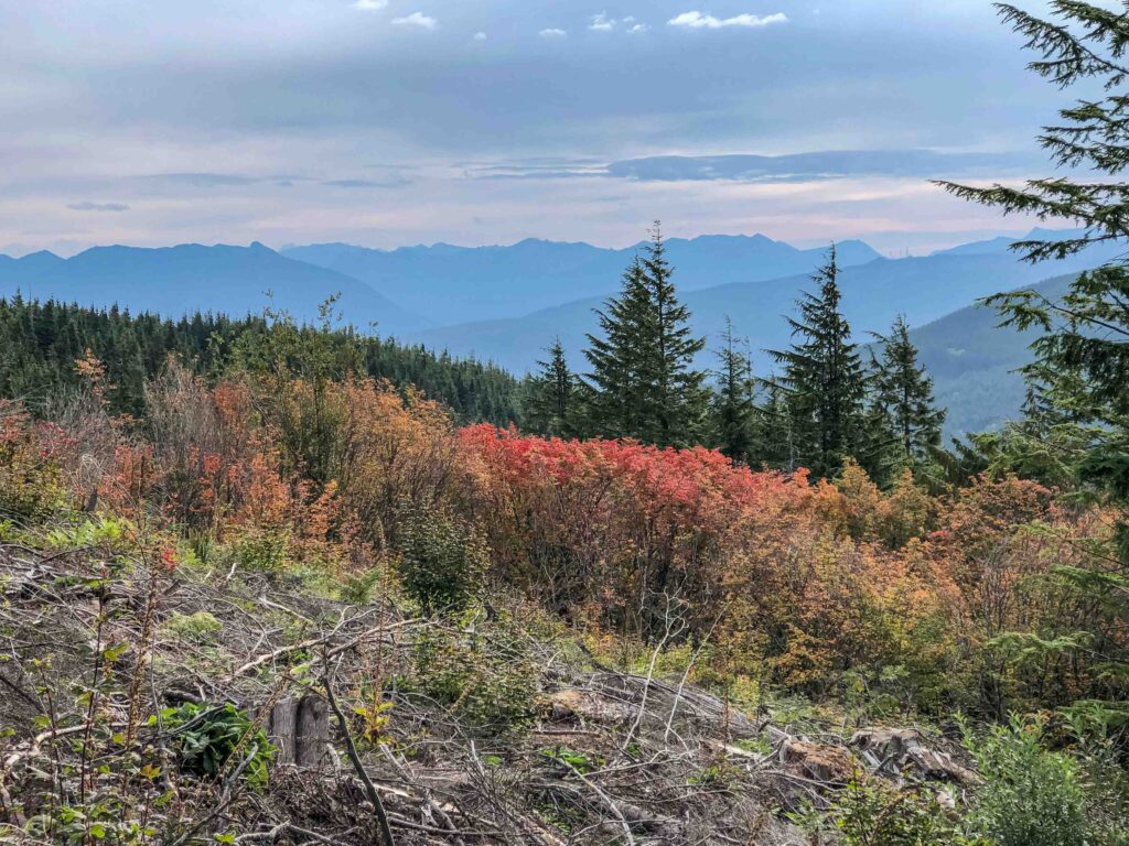
Such an idea is not new to this blog. I wrote about setting intentions on Mt. Washington in May. What if we set an intention to handle unexpected events with ease, grace, and humor? Last fall I reflected on the beauty of hiking Granite Mountain in the shoulder season, not expecting the gorgeous fall foliage. The unexpected can be positive…and negative.

Almost two years ago I discussed how to turn disappointment into gratitude at Blanca Lake when we arrived in fog, only to have it lift shortly before we left. One of the reasons I continue to venture to the mountains is I recognize Mother Nature has a lot to teach me. So what would Cougar Mountain reveal?

Narrow boardwalks snake through Shy Bear Marsh on a circuit from Whitaker Peak to Doughty Falls. We didn't encounter anyone coming in the opposite direction, or crossing could resemble a game of Twister.
Narrow boardwalks snake through Shy Bear Marsh on a circuit from Whitaker Peak to Doughty Falls. We didn’t encounter anyone coming in the opposite direction, or crossing could resemble a game of Twister.

Expect the Unexpected #1: Early Fatigue

Last Wednesday, the three of us headed for Exit 15 and the Whittaker Wilderness to do a 7.5-mile loop up Whittaker Peak to Shy Bear Pass to Doughty Falls. We headed up the trail at 8:25 a.m. I’d put a lot of thought into this choice. My desires were to prevent any of us from getting overheated, avoid sitting in traffic during road construction or rush hour, and enjoy a new trail without a lot of crowds. While we accomplished all three, we each faced our own obstacles.

The first unexpected obstacle was one my daughter faced. I could tell within ten minutes that she was having an off day. We stopped after ten minutes for a rest. Ten minutes later, while I was barely feeling warmed up, she dragged herself to a boulder and sat, dejected. The “go forever” solo hiker voice inside me reared its ugly head but I successfully squelched it. After all, we were doing something together as a mom and daughter. It was a gorgeous day and we had until early afternoon.

The mossy, fern-filled Cougar wilderness right before our first clothing break. Ajax wanted to dash ahead but we kept him on his leash.

Taking Weight

After thirty minutes, and our third break, I resorted to diversion tactics including cracking jokes. Then I tried becoming a sleuth. Had she eaten breakfast? Were her feet feeling okay? It turns out she’d really been looking forward to having another person join us. But both people we’d invited had other plans. So part of the problem was disappointment. And perhaps the fact that there was no lake on this hike had her unmotivated.

On the fly, I told her we wouldn’t go all the way up to the Whittaker Peak summit, we’d just do the flatter loop. Even that news didn’t motivate her. When I finally asked if she wanted to go back to the car, she said yes, but she didn’t want to feel like a loser.

On the ascent, I simply strapped her pack on my front like a Baby Bjorn front carrier. On the way down I got smart and unloaded her stuff into mine and folded up her pack. That way I could see my feet and reduce the risk of a fall.

“We all have off days. Just because someone turns around doesn’t make them a loser,” I told her. But she gets her stubbornness from her independent parents. She refused to budge. I offered to carry her pack to see if that helped. We finally got moving again.

Doughty Falls

Fortunately, we raised a resilient teen. Once we’d completed most of the gain her oomph and enthusiasm returned. She just doesn’t like steep uphills; I get that. We meandered past Shy Bear Pass and over boardwalks at Shy Bear Marsh, finally reaching Doughty Falls around 10:45 a.m.

“More like Doughty Trickle,” I quipped. She preferred “Doughty Leak.” Who am I to argue? This time of year ferns drape the rocks but nothing more indicates a waterfall except lush green and a drop-off. Still, it was our farthest destination, so we stopped for a snack.

The author takes a selfie at "Doughty Leak." I preferred "Doughty Trickle" myself...
The author takes a selfie at “Doughty Leak.” I preferred “Doughty Trickle” myself…

Expect the Unexpected 2: Ajax’s Mallady

About half a mile later, Ajax acted as though he’d gotten stung, stabbed, or bitten. He pawed at his face and then immediately rolled around in the dirt. Was he trying to deaden the pain or get rid of something in his face? When he stood up, it looked like he’d done something to his left front paw. He took a few steps and then plopped down and refused to go.

My daughter checked out his paw to see if he had anything embedded in it. Would we have to carry him? I was already carrying both our packs and wasn’t sure I could carry the dog, too, even using his suitcase harness. The only option we had left was to let him rest and see if he could walk out on his own.

Our pooch, resting on his non-favorite side. Flashbacks to my other dog, Emily, and her death in 2012 had me near tears. I would NOT let it happen. Ajax is only eight. But if we expect the unexpected, we know that someday life for loved ones will happen. It doesn't make it any easier.
Our pooch, resting on his non-favorite side. Flashbacks to my other dog, Emily, and her death in 2012 had me near tears. I would NOT let it happen. Ajax is only eight. But if we expect the unexpected, we know that someday life for loved ones will happen. It doesn’t make it any easier.

Tricks to Try

Something similar with Ajax had happened twice before: once on a hike of Mailbox Peak, when he started limping for no apparent reason, and the other during a winter hike on Big Tree Ridge. Both times he recovered with rest. Little Man can’t talk, but he is a good communicator. I knelt to give him a paw massage, and after we let him rest for fifteen minutes, my daughter commented that he looked dead.

I had one last trick up my sleeve. Cheese. His favorite treat. I tore off tiny bites and handed them to him. That perked him right up. He didn’t stand, but he did look interested. At that moment I knew, somehow, he was going to be okay. After five bites and some water, I repacked my bag and he stood up. He took a few tentative steps with a faint limp. But after that, he seemed fine. Crisis averted.

My daughter and I discussed the challenges of having four legs and losing use of one, or having two and losing use of one. Many three-legged dogs adapt just fine; humans can get a prosthetic. But which would be easier?

Expect the Unexpected #3: Emotional Tidal Wave

My own obstacle followed shortly thereafter. We rounded the corner where the paths leading to Whittaker Peak and Gombu Wilderness Cliffs diverge. A woman was supervising a large number of children clambering around a mossy boulder. They had a large off-leash and highly energetic Swissy with them who wanted to play with Ajax.

I politely told the child closest to the dog that my dog just injured his paw and would she please call off her dog. The woman uttered something like, “Thank you for asking politely, calmly, and respectfully.” I nodded as we walked by. I remember thinking, “She must be modeling kind behavior for her kids.” As Ajax and my daughter disappeared ahead of me, something snapped.

Ajax poses by an enormous moss-covered log in the Whitaker Wilderness in the southeast corner of Cougar Mountain.

Triggers

Seeing my best canine friend lying on the dirt, perhaps injured – could I have prevented it? – and having my daughter use the word “dead” triggered a wave of anticipatory grief. Eleven years ago we lost our first dog to lung cancer. Hearing the woman use the word “calm” for me, when I felt anything but, did something more. Add to that my daughter calling the trail “boring” and my fears that she was no longer enjoying hiking with me and I lost it.

A tidal wave of emotions rushed through me. Shame. Guilt. Grief. Sadness. Frustration. Longing. The slightest thing can unleash a torrent out of nowhere. Traumatic experiences like euthanizing a beloved pet can do that. I know if and when I lose Ajax it will be the worst pain I can possibly imagine. Nothing can prepare us for that.

But not yet. Thank the powers that be, not yet.

My eager Little Man, always ready for anything. He's the best hiking partner anyone could ever ask for.
My eager Little Man, always ready for anything. He’s the best hiking partner anyone could ever ask for.

Fortunately, my daughter was ahead of me. I knew I needed to let the tears out and then get my act together. I took several deep box breaths to help move past the hurt. But not before she noticed me rubbing my head.

“Are you okay?” she asked. I nodded.

“Did you get stung?”

“Only in the proverbial sense.” I assured her I was fine, just dealing with emotional demons. And the rest of the hike unfolded uneventfully.

Two intricate and fascinating snails on the Cougar trails.
I know my worries are first-world problems. They still feel stressful.

Takeaways

Perhaps the biggest takeaways from this experience of unexpected events are twofold: that we have the knowledge we need deep inside us. Our job is to listen, to tap into it, and to trust it. And Mother Nature teaches us what we need to know when She knows we can handle it.

My job is to amass as many tools as I can so I don’t get blindsided by grief the next time it comes. I know it’s coming. And I am preparing. But I won’t let that detract from today’s happiness. Over the past two years, I have shared a number of techniques and tips around embracing change and getting unstuck. Knowing what to do, however, doesn’t necessarily make it any easier.

Two posts ago I asked readers to share their “close calls.” This week please share any surprising obstacles that caught you off guard for which you felt under-prepared. What resources do you draw on to get through tough situations? How do you remain calm when you feel the world is collapsing around you?

Talapus and Olallie Lakes: How to Enjoy Your Visit

On a recent hike to Talapus and Olallie Lakes, I practiced “channeling my inner wood duck” (i.e. going with the flow). Ajax, my daughter, and a friend joined me on a sunny midweek adventure. To enjoy the trip yourself, plan on allowing at least 30-45 minutes to explore the shoreline at each lake. Join us on our journey into the woods.

Log jam at Talapus Lake under perfect conditions.

At the Trailhead

We reached the trailhead at Exit 45 a little before 9. I’d suggested we leave early since we’re in peak hiking season and the Talapus Lake parking lot is small. Eleven cars were already parked when we arrived, leaving plenty of spaces. Hurray for midweek hikes!

The four of us headed up the Talapus Lake trail under sunny, clear conditions with a light breeze. More like what our guest, Zach, was used to in Arizona, rather than the rain we experienced four days earlier at Wallace Falls. This time he borrowed a water bottle and refilled it twice before starting the hike. There’s always something unexpected with teenagers!

Red marks and blue tape on select trees denote the extent of the logging area.

Trail to Talapus and Olallie Lakes

The area near the parking lot has recently been logged up to a sign indicating the boundary of the Alpine Lakes Wilderness. WTA trail maintenance crews have worked extensively on this wide, moderate trail over the past decade, most recently in 2021. Since I have only accessed Talapus and Olallie via the Pratt Lake trail (at exit 47), I was excited to explore a new trailhead. We were not disappointed.

The din of I-90 traffic faded as we gradually climbed into a denser forest. My daughter and Zach hiked ahead with Ajax while I hung back to identify birdsong (17 species including a red-breasted sapsucker, a type of woodpecker) and shoot photographs (113) of treasures in the peaceful woods.

Gentle switchbacks lead to Talapus and Olallie Lakes.
A close-up of what I loosely call shelf fungus with dew drops.

Waterfall Detour

One of the advantages of hiking in a small, private group rather than a larger guided group is the freedom and independence to explore. When we came across a river cascade beyond an enormous fallen tree, we meandered off-trail in search of cool vantage points and photo opportunities.

My heart nearly stopped when Zach contemplated crossing a mossy log that had fallen across a stream. When he glanced over at me shaking my head, he changed his mind and found another way. They may both be adults, but teen brains are still developing. Thoughts of emergency first aid and “what if” raced through my mind until we were safely back on the official trail. If there is a way to squelch the mothering instinct, I haven’t found it.

Talapus and Olallie Lakes: How to Enjoy Your Visit

At Talapus Lake we stopped for a short water break and agreed to continue to Olallie Lake first. Then we could backtrack and spend more time anywhere that caught our interest.

I had one momentary fright when I slipped on a wet log. In a split second, I landed on my left forearm, flashing back to my fall in the Fiery Furnace 18 months ago. This time, I practically bounced off the pine needles and hopped back onto my feet, and dusted off the dirt, but not before they both noticed. My daughter raced back to check on me. I assured them both that I was totally fine. But I silently asked myself, is it age? Lack of attention? Terrain challenge? Or could there be a deep core muscle that is no longer engaging properly?

Olallie Lake Wading

After brushing off from my fall, we continued along the west side of Olallie Lake, scoping out campsites for a future backpacking trip. At a nice sunny vacant spot, we stopped to have lunch and clean away the rest of the dirt. Beautiful tiny butterflies flitted around our packs. They were so light I couldn’t even feel the one that perched on my hand.

Olallie Lake Basin Area Map.
A frog near Olallie Lake's shore, enjoying the day.
A frog near Olallie Lake’s shore, enjoying the day.

When I invited them to go in the water, Ajax stayed on shore. He can swim but only if someone carries him in and lets go. We decided he should stay dry.

The view south from one of the northern campsites. We backtracked to get closer to the water.
Our lunch spot.
Our lunch spot.

The water is, as you’d expect, cold. But also delightfully refreshing. When I spotted a frog, my daughter grabbed her camera to take some photos. An item that would have been useful: a towel. I never bring one for day hikes, but for an overnight near a lake, it would come in handy. Since we still had a second lake to explore, we dried off our feet and headed back toward the log jam at Talapus Lake roughly 1.5 miles away.

Talapus Lake Log Jam

Olallie has a decent wading area with a sandy bottom. Talapus Lake has floating logs. Brooke and Zach both wanted to test their balancing skills. When they asked how much time we had (they wanted to take their shoes off there, as well) I said we could stay longer if they’d entertain me in traffic on the way home. While they hurled sticks into the lake, I found a spot next to Ajax to write in my journal.

Talapus and Olallie Lakes: How to Enjoy Your Visit
Exploring the log jam at the southern end of Talapus Lake.

The choice to linger meant adding time in the car on the drive home. The closer we got to rush hour, the more time I guessed we’d spend stuck in road construction between exits 24 and 18 westbound on Interstate 90. But because we expected it, we entertained ourselves on the drive by playing The Alphabet Game and looking for interesting license plates and bumper stickers.

The Alpine Lakes wilderness is full of fascinating trees. This "seat" was perfect for Brooke and Ajax.
The Alpine Lakes wilderness is full of fascinating trees. This “seat” was perfect for Brooke and Ajax.
Ajax spotted several bold chipmunks. He didn't give chase but the drool showed he wanted to.
Ajax spotted several bold chipmunks. He didn’t give chase but the drool showed he wanted to.

Choosing Between Talapus and Olallie Lakes

The best things about these two lakes are they’re close enough to visit both on the same hike. If you park at the Pratt Lake trailhead, you’ll reach Olallie first. Both are worth seeing. As to which is better, I didn’t raise that question. Frogs or logs? Which do you prefer?

Tree planter near the trailhead. Young kids will enjoy the diversity of tree shapes on this trail.

How to Enjoy Rain on a Hike to Wallace Falls

On Father’s Day, my husband, our daughter, a friend from Arizona, and Ajax joined me for a hike to Wallace Falls. Mother Nature supplied plenty of rain, mist, and sun breaks along with plenty of puddles. The result? One very muddy dog. Fortunately, the hail waited until the long stop-and-go drive home. As a fair-weather hiker, I’ve recently come to enjoy rain because it provides cooler weather, a lower risk of sunburn, great photo opportunities (clouds make for interesting light), and fewer people. All contributed to a unique experience.

Wallace Falls is spectacular this time of year. It reminded me of being in a rainforest. Mist rebounds from the cascade, filling the valley. Or is that rain?

Uh-oh!

The last time Ajax and I visited this park was on a hike to Wallace Lake two years ago (see my blog post from August 2021). This year, a sign outside the parking lot declared it to be full, but we soon realized that was probably the case for a crowded and sunnier afternoon the day before. We quickly found a suitable parking spot in the half-full lot and traded sneakers for boots.

Missing Boots

Except somehow, my daughter’s boots never made it into my husband’s car. I had a second, older pair in my car, but she doesn’t wear my size. Would we have to turn right around and go home without taking a step?

Fortunately, my daughter and husband wear the same size. He offered to hike in his sneakers so she could wear his boots. The lightweight slip-ons she wore on the drive never would have held up to a mile of mud, much less six. Crisis averted, we locked the car and headed up the trail at 9 a.m.

Group photo of me, Zach, Ajax, and Brooke at the start of the Woody Trail, our route to Wallace Falls.

No Raincoat

Our guest, Zach, and his parents were my hiking partners for the wonderful learning experience on Mt. Wrightson in Arizona. I knew he would be fine on whatever hike we chose. But he’s used to Arizona sun and heat. They don’t have many waterfalls or lakes. The thought of bringing a raincoat never crossed his mind.

No boots for one; no raincoat for another. In typical motherly fashion, I ruminated about how my daughter was doing up at the front of our group in her borrowed footwear. Did our guest have enough snacks and warm clothing? Was my husband actually enjoying his Father’s Day in the rain, or merely tolerating it? Surely we’d faced the worst.

Baby Grouse Chicks

I was wrong.

To avoid being pulled into muddy puddles, I let Ajax off-leash. He’s usually very good with voice commands. Unless he spots a mother grouse with baby chicks.

Majestic Ajax in his muddy harness. This was taken off the beaten trail, where we could access Wallace River before it plunges over the falls.

Strike three. Fortunately, I believe the baby grouse will survive. But we revoked Ajax’s off-leash privileges for the rest of the day.

Let Nature Be Your Teacher

As we ducked into the forest, we traded the annoying buzz of power lines for the refreshing sounds of cascading water. Ajax and I paused to capture a photo of the William Wordsworth quote that greets guests to the solace and beauty of the park.

Ajax seems to enjoy rain. Here he stands in a puddle at the base of the sign. He got two baths after the hike, a cold one at the trailhead and a warm one at home.

On the rainy hike, my husband and Zach traded stories and questions until we paused at the picnic shelter for our first snack break: kibble for Ajax, homemade cookies for the kids, and ground beef for my husband. I chose to visit the vantage point for the lower falls. The volume of water flowing this time of year is truly mind-boggling.

Zach later admitted that his experience at Wallace Falls was “otherworldly.” Hiking in mud and rain must have felt as different for him as hiking in the arid Arizona April heat had been for me. Nature is an awesome teacher, if we’ll only pay attention to her lessons.

The author at Lower Falls.
Brooke and Zach shoot photos of Lower Falls.

Enjoy Rain Mixed with Sun

People often joke about Pacific Northwest weather: if you don’t like it, wait a few minutes. We felt the air around us warm as we hiked higher and tried to figure out why that was. My guess is the clouds were growing thinner, which meant more of the sun’s strength could reach Earth. We paused at each vantage point for photos, continuing all the way to the bridge that crosses Wallace River where we spent time gazing at the rushing torrent beneath us and exploring off-trail down to the river.

On our return to the Upper Falls after exploring the bridge at the top, we got rewarded briefly by a visit from the sun.

The bridge at the very top of Wallace River. Note the very wet wood.

Now, we can look back at our experience and laugh about those things we forgot and about our soggy doggy. (I offered to sit next to Ajax so our guest could sit in the front.) Trips are made far more memorable whenever obstacles are thrown in our path.

We’ve also rediscovered that the westbound single-lane highway east of Everett is a headache to travel on weekends. It was true three years ago. Maybe even more so now.

However, we salvaged the drive home with a Word Chain game in which we chose a category (geography) and round-robin fashion, had a person name a geographic feature and the next person come up with something starting with the letter the previous person ended with. And did I mention hail?

Enjoy rain but hope for the sun. It made a brief entrance shortly before noon.

Enjoy Rain: Takeaways

The Mountaineers organization recommends that every hiker carry the Ten Essentials (or the updated “ten essential systems“) on the trail. These include extra food and water, a First Aid kit, extra clothing, and a map and compass for navigation.

It’s one thing to think you have it and another to have it. One strategy to use to avoid our mistake is to check with all party members ahead of time to be sure they actually brought what they need so that you avoid a painful surprise at the trailhead.

And we’re going to keep hiking in the rain in the summer. With the right gear, it provides a pleasant experience and interesting lighting. What “close calls” have you had in the mountains and what creative ways did you handle it? Please share in the comments so we can all benefit and learn.